Based in Iseyin, Oyo State, Nigeria
+234 803 478 4082
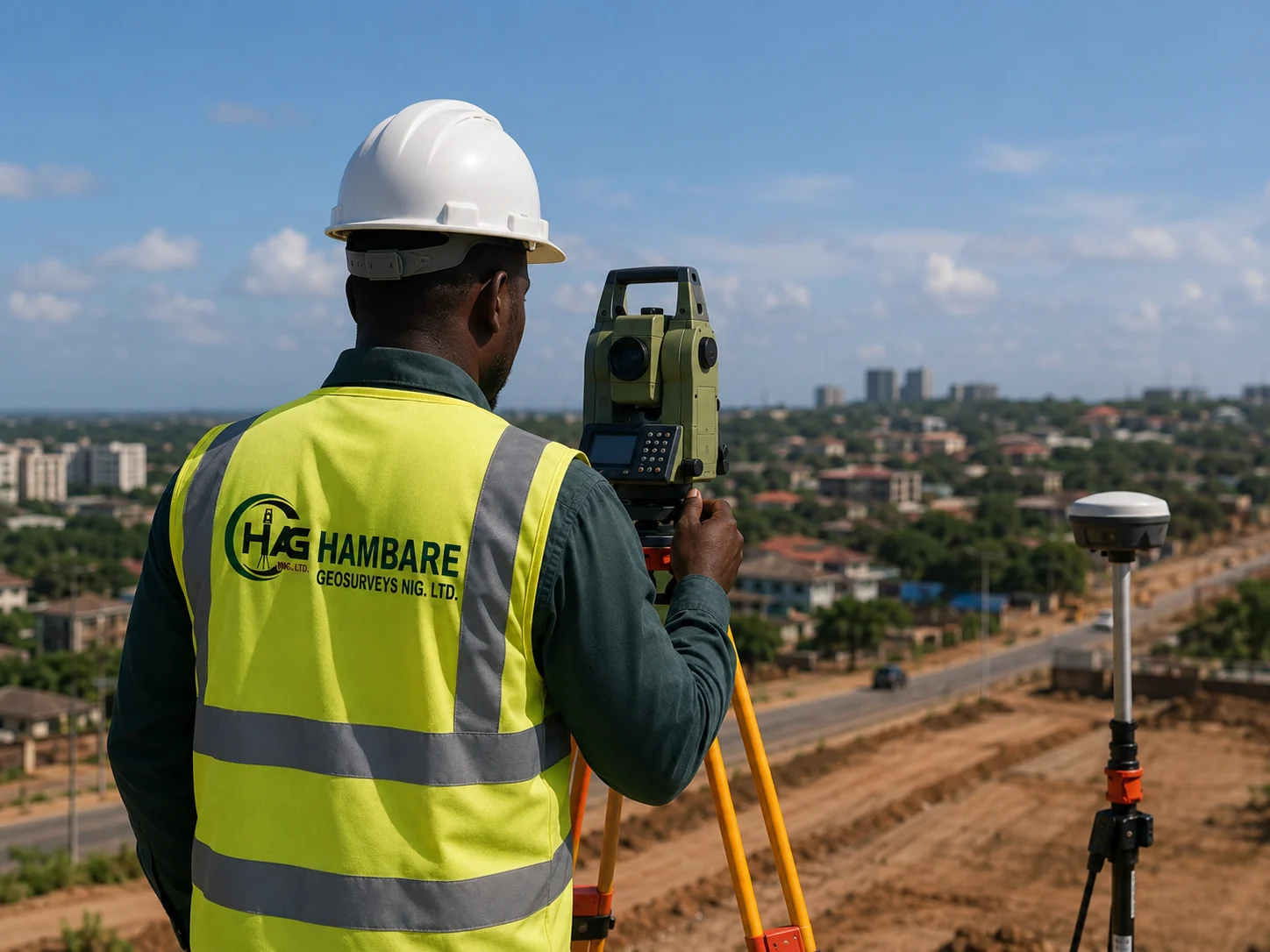
Surveyor in a Hambare Geosurveys vest operating a total station above an urban area
ACCEPTING NEW SURVEY ENQUIRIES
Land · design · construction · spatial data

Know exactly where you stand.

Boundary, topographic and engineering surveys that turn field measurement into decisions for land, design and construction.

Registered Surveyor Hamid Adebare Direct line +234 803 478 4082
Core services

Surveying and spatial services.

Choose by project need. Scope, field method and deliverables are confirmed before mobilisation.

01

Boundary & cadastral survey

Identify parcel limits and prepare survey information for land documentation and boundary decisions.

Typical outputs Boundary plan · coordinates · survey records
02

Topographic survey

Capture terrain, levels and visible site features for planning, feasibility and design.

Typical outputs Topographic plan · contours · CAD data
03

Engineering survey

Transfer design positions and levels to site, establish control and record completed work.

Typical outputs Setting-out data · checks · as-built records
04

GIS & spatial analysis

Turn land records and locations into clear digital maps you can search, share and use for planning.

Typical outputs GIS layers · maps · databases · analysis
05

Remote sensing

Use satellite or aerial imagery to examine land cover, development and change across an area.

Typical outputs Image maps · classifications · change analysis
06

Land & spatial advisory

Not sure what survey you need? We look at what you already have and recommend the right next step.

Typical outputs Scope advice · data review · mapping support
Not sure what to request?

Start with your project goal.

Select the decision you need to make. The site will suggest a practical survey route and add it to your project brief.

Recommended route

Boundary and cadastral survey

Confirm parcel identity, corner positions and the survey information needed for a land or boundary decision.

Bring
Location, available survey plan or title documents, access details
Possible outputs
Boundary plan, coordinates and survey records
How a scope is built

Purpose, reference, requirement, output.

Every assignment is scoped the same way before anyone mobilises to site, so the survey method matches the decision it needs to support.

Diagram showing purpose, reference control, requirement and deliverable flow used to scope a survey
HAG / Technical note 01
Field to file

Measurement, context and usable output.

Two stages of the same job: instrument time on site, and a structured file someone else can build on.

Black Nigerian surveyor viewed from behind in a Hambare Geosurveys reflective vest operating a total station
01 / FIELD MEASUREMENTControl, observations and site records.
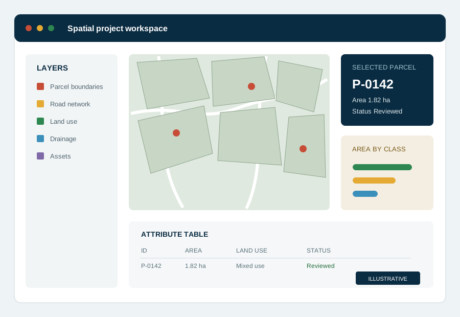
Illustrative GIS workspace showing layers, parcel attributes and an analysis panel
02 / DIGITAL OUTPUTCoordinates, layers and export-ready files.

The field photograph is representative of Hambare's survey practice and is not presented as evidence of a specific completed project. The workspace graphic is an illustrative sample, not project data.

Deliverables

Know what you are commissioning.

These illustrations show common output types. The exact content and file format are agreed for each project.

Illustrative output

Boundary plan

A controlled representation of parcel geometry, corner points, bearings, distances and relevant survey information.

  • Parcel geometry and corner references
  • Bearings, distances and coordinates
  • North point, scale and survey notes
Possible formatsPDF · print · CAD · coordinate schedule
1 of 4Select a tab or use the arrows
How a project starts

Four clear steps.

01

Tell us what you need

Send the location, purpose, available records and required output by form, call or WhatsApp.

02

Agree the scope

Field method, access, deliverables, timing and commercial terms are agreed.

03

Survey the site

Field observations, control and checks are completed for the agreed purpose.

04

Receive outputs

Plans, coordinates, files or reports are delivered in the agreed format.

Hambare Geosurveys Nig. Ltd.

Survey support for land and development decisions.

Hambare provides surveying, engineering measurement, mapping, remote sensing and GIS support for land, design and construction decisions.

Download capability statement
Registered surveyorHamid Adebare
Company registrationRC 1530958
Operational addressAlhaji Balogun's House, Oke-Esa, Iseyin, Oyo State
Direct contact+234 803 478 4082
Request a survey quote

Send a useful project brief.

Complete the essentials below and a message is prepared for WhatsApp. Prefer not to type? Call or the surveyor directly instead.

Before you start

Three things to include

  1. Describe the project.Choose the closest service, location and stage.
  2. State the output.Add available records, timing and access information.
  3. Send it on WhatsApp.Review the message below, then attach any plans or photographs.
Download the checklist
Form progress0 of 5 required fields completed

Fields marked * are required. Everything else is optional, so fill in what you know and leave the rest blank.

01
Project basicsWhat is the work and where is it?
02
Outputs and logisticsWhat should be delivered and what is already available?
03
Purpose and contactWhat decision will the survey support and who should receive the response?
Step 1 of 3

Plans, drawings and site photographs can be attached after WhatsApp opens.

Speak with the surveyor

Talk to Registered Surveyor Hamid Adebare.

Call or send the location, purpose and available documents on WhatsApp.

WhatsApp
Illustrative boundary plan

Illustrative technical output. Final content depends on the agreed scope and intended use.